Four aircraft went on a flight to the middle of Australia.
Alice Springs, Uluru (Ayers Rock), Simpson Desert, and the Channel Country.

3 Savannahs and 1 Zenith 701.

A typical road in outback OZ.

One of many open-cut coal mines.

The abandoned Mary Kathleen uranium mine, 1958 - 1982.

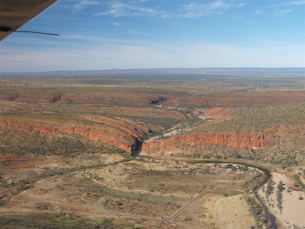
The small settlement of Urandangi.

The waiting room at Urandangi airfield.

Two days of steady rain at Bond Springs, near Alice Springs.
Most unusual this time of year.

Luckily we had a dry hangar to camp in.

Pine Gap joint Australian/American defense base.
It monitors and interprets satellite communications worldwide.

Top secret, this is a close as we are allowed to go.
Looks very mysterious.

Henbury meteorite craters.
 The Western MacDonnell ranges.
That good rain a few days ago already greening the land.

Some amazing rock formations.

The ancient Finke River cutting through the ranges.
The uplift of the mountains has been so slow that the river was able to cut through.


At Hermannsburg Aboriginal settlement airfield.
No alcohol allowed.
The mailbox for the flying mailman.

Kings Canyon, a popular tourist venue.

Kings Canyon from above.

Uluru (Ayers Rock) at first light.

The start of a new day for the tourists at Uluru.

It is a magnificent sight, eh.....

The ever changing moods of 'The Rock'.


The Olgas, Kata Tjuka (many heads) to the aboriginals, Uluru in background.

Mt Connor

Refueling at Kulgera Roadhouse.
From here I went off on my own, the way I prefer to travel.

The Lambert Center of the Australian continent.
If you cut out a cardboard shape of OZ and balanced it on a pin, this would be it.

Wild camels. There are about one million in Australia.

The Finke River, far from that gorge in the MacDonnell range.
It eventually just peters out in the desert.

Typical view of the Simpson Desert.

Dalhousie Springs.
Hot salty water spills out and evaporates leaving the salt deposits.

An abandoned airstrip, built by oil survey crews in the 60's.
I landed there and camped the night.


That's a lonely gum tree down there, hundreds of miles from any of it's kind.

The gum tree appears to be surviving well in this harsh climate.

The most desolate part of the desert.

All barren and salty.

The Channel Country at its prime.
Two rivers flow into this flood plain.
The rivers are ephemeral, and only flow periodically, but then they spread out
and form this vast natural irrigation area.
Terrific cattle feeding country, wild cattle, no antibiotics or pesticides,
genuine 'organic' beef.

...........................................................................
And that's it for this trip.